


Snowshoeing in Clarée
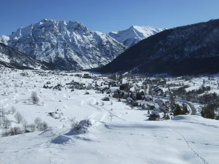
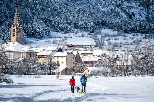
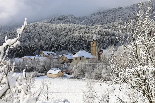
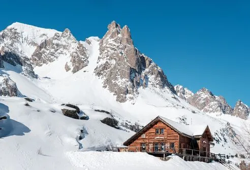
Envie de découvrir les Alpes autrement en hiver ? La vallée de la Clarée, située dans le Briançonnais entre Névache et Val-des-Prés, est l’un des plus beaux terrains de randonnée en raquettes dans les Hautes-Alpes.
La Clarée offers the most beautiful snowshoe hikes in the Hautes Alpes!
In the heart of awild and unspoiled valley, near Briançon – Serre-Chevalier, you can enjoy gentle walks around the villages and hamlets between Val-des-Prés and Névache, and hikes in the upper Clarée valley, between the river, forests, and alpine hamlets. When you walk here, you'll want to stay forever!


Come with us
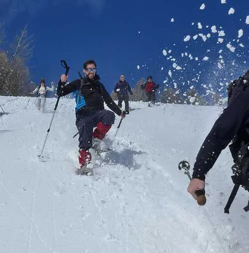
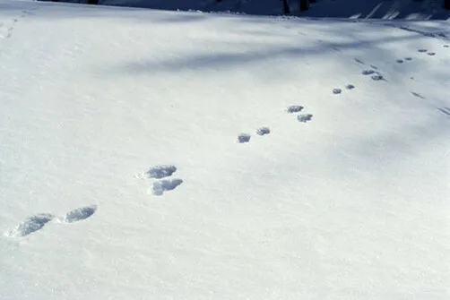
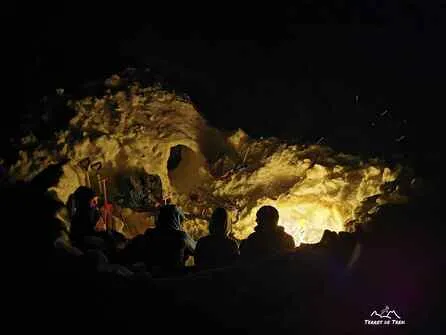
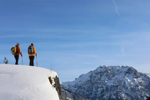
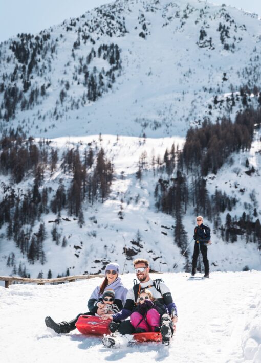
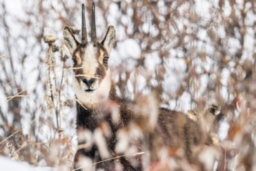
Set off to explore footprints in the snow, encounter wildlife, reach the summits with breathtaking panoramic views, spend a night in a cozy refuge in the heart of the mountains... accompanied by a mountain professional!
The guides and mountain leaders of La Clarée offer snowshoe walks and hikes to help you discover nature in a different way!
-
- Névache
- Val-des-Prés
-
Névache
 activity
Weekend: “2 days to suspend time” – A…
- Accompanied
- Equipment rental
-
Névache
 Bookactivity
Snowshoe Hikes – Terres de Trek
- Accompanied
- Equipment provided
-
Val-des-Prés
 activity
Snowshoe outing – Tracks and clues -…
- Accompanied
- Equipment provided
-
Névache
 activity
Winter survival course with overnight stay in...
- Accompanied
- Touring
- Equipment provided
- Race
- 1

A Névache :
le pass évasionPopular with skiers, the Névache Valley is also a delight for hikers, snowshoers, and dog sledding enthusiasts, who are now asked to pay a fee to enjoy the many marked, maintained, and secure trails maintained by the municipality.
It should be noted that, apart from these groomed, marked, and secured trails, the entire mountain remains accessible free of charge to those who prefer to enjoy the great outdoors equipped with snowshoes, cross-country skis, and other snow-appropriate gear.
Why should I participate?
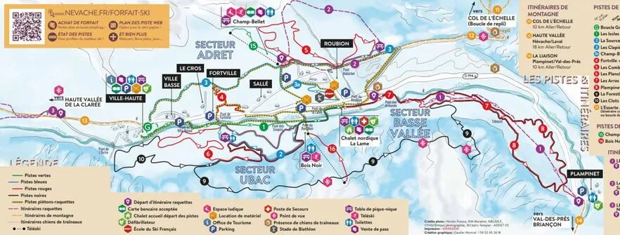
Useful information Maps, webcams, snow conditions


Itineraries and snowshoe hikes
The upper Clarée Valley and the Col de l'Échelle, starting from Névache, or the Granon chalets, starting from Val-des-Prés, are among the many routes to discover for a guaranteed change of scenery.
With snowshoes on your feet, the mountains become accessible to everyone! Whether in Névache or Val-des-Prés, set off to discover the most beautiful snowshoe hikes in the Briançonnais region and enjoy a truly immersive experience in the great outdoors!

- Facile-Vert (7)
- Moderate-Blue (10)
-
- Névache
- Val-des-Prés
-
Névache
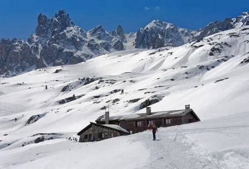
Snowshoeing up to the Drayères refuge
- Distance 12km
- Durée journalière 04:00
- Dénivelé positif 560m
- Dénivelé négatif 560m
-
Névache
The Névache Belvedere on snowshoes
- Distance 4km
- Durée journalière 02:00
- Dénivelé positif 148m
-
Névache
The Col de Buffère on snowshoes
- Distance 15km
- Durée journalière 06:30
- Dénivelé positif 950m
- Dénivelé négatif 950m
-
Névache
Snowshoeing up to the Chardonnet refuge
- Distance 7 km
- Durée journalière 03:30
- Dénivelé positif 623m
-
Val-des-Prés
Snowshoeing in La Vachette, Les Alber…
- Distance 4.3km
- Durée journalière 01:30
- Dénivelé positif 55m
-
Névache
Tour du Village de Névache – pedestri…
- Distance 5 km
- Durée journalière 02:00
- Dénivelé positif 130m
-
Val-des-Prés
Snowshoeing between Val-des-Prés and…
- Distance 12km
- Durée journalière 03:30
- Dénivelé positif 210m
- Dénivelé négatif 210m
-
Val-des-Prés
Snowshoeing to the Granon chalets
- Distance 9km
- Durée journalière 04:00
- Dénivelé positif 520m
- Dénivelé négatif 520m
-
Névache
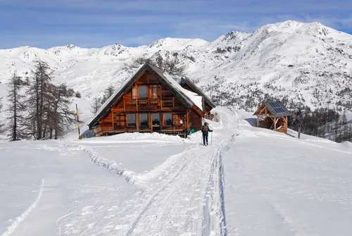
Snowshoeing up to the Laval refuge
- Distance 9km
- Durée journalière 03:00
- Dénivelé positif 500m
- Dénivelé négatif 500m
- 1
- 2
Itinéraire de la haute vallée de la Clarée
Pour une immersion totale dans la magie de la Haute Clarée, suivez cet itinéraire qui part de Névache – Ville-Haute et serpente doucement au cœur de la vallée. En empruntant la route d’été enneigée, vous traversez les paysages emblématiques de la Clarée : forêts de mélèzes, vastes plaines blanches et panoramas spectaculaires sur les sommets environnants.
📍24 km aller-retour entre Ville-Haute et Laval
Cet itinéraire peut se parcourir en raquettes ou à pied selon les conditions, mais aussi en ski de fond, ski de randonnée ou en luge. Cette route hivernale est partagée entre plusieurs pratiques : pensez donc à vous renseigner sur les conditions avant votre sortie et à adopter les bons réflexes pour cohabiter avec les autres usagers.
Prenez le temps d’observer les paysages, de profiter du calme de la vallée et de découvrir l’un des plus beaux itinéraires hivernaux de la vallée de la Clarée.
Chuttt ! Ne pas déranger !

Note safety note

CONSULT THE WEATHER FORECAST BULLETIN
Note that in winter the days are shorter.

WATCH THE AVALANCHE BULLETIN
There is no such thing as 0 risk in the mountains. Consult the BERA to find out about possible risks, and don't commit yourself if it's too risky.

DRESS WARMLY
and take extra warm clothing no matter how long the hike. Weather conditions can change rapidly in the mountains

PROVIDE FOOD AND WATER
Depending on the length of your hike, remember to bring enough food and drink to take a break and regain your strength!

CHOOSE AN APPROPRIATE ROUTE
your physical condition, abilities and knowledge of the mountains

TOPO-GUIDES, YOUR BEST FRIEND!
Read topographical guide recommendations

DON'T GO IT ALONE
and inform family and friends of the itinerary chosen and the expected time of return.

TURN AROUND
if the itinerary becomes complicated, or in case of doubt or concern

PROVIDE SAFETY EQUIPMENT
avalanche beacon, shovel, probe


