Back
randonnee
Back
randonnee
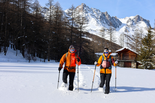
Snowshoeing up to the Chardonnet refuge

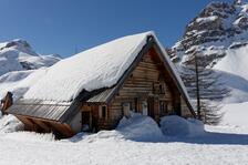

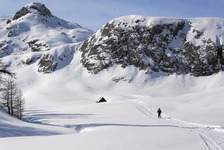
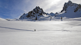
Gain height to reach the magnificent Chardonnet valley and its refuge, nestled at the foot of the imposing Raison and Diable crests. The route to the refuge is a little long, but not particularly difficult.
Description
From Ville Haute, take the Haute Vallée road, snow-covered at this time of year and occasionally groomed.
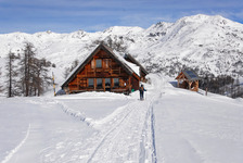
After passing the chalets du Verney (approx. 4km), the Pont de la Souchère can be seen in a bend on your left below the road (a wooden sign indicates the name of the bridge). Follow the sign to continue along the right bank for approx. 500 metres. A "Chardonnet" sign will show you a path leading up on the left towards the refuge. If this path is not marked, follow the right bank path to Fontcouverte. After the Auberge de la Fruitière, a large wooden sign indicates the main climb to the refuge.
From the Refuge du Chardonnet, it's possible to climb up to the Col du Chardonnet, in which case you should allow 2 hours' ascent from the refuge and 440 vertical metres for just over 3 km to the Col. For this ascent, we strongly advise you to check snow conditions with the warden, consult the BRA for avalanche risks, and carry a DVA-shovel-probe kit.
Complément accueil
Find out when the refuge is open and make sure you book in advance.
Remain vigilant:
- You need to be aware of changing weather and snow conditions.
- G.R. trails and other routes used in summer are not always the same as winter trails.
- Because of the risk of avalanche, we strongly recommend that you wear full safety equipment (avalanche transceiver, probe and shovel).
- Mountain guides are there to accompany you on this winter terrain, which they know well.
Prices
Free access.
Itinerary
-
 Distance
7km
Distance
7km
-
 Type d'itinéraire
Aller simple
Type d'itinéraire
Aller simple
-
 Dénivelé positif
623m
Dénivelé positif
623m
-
 Daily duration
03h30
Daily duration
03h30
Ouverture complémentaire
-
Subject to favorable weather
-
Subject to snow conditions
Location


-
Distance
7km
-
Daily duration
03h30
-
Dénivelé positif
623m
-
Type d'itinéraire
Aller simple