Retour
randonnee
Retour
randonnee
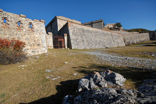
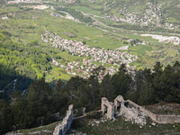
L'ancien fort de la Croix de Bretagne

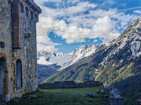
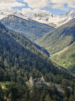
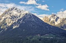
Set off through the woods to discover this fort built between 1876 and 1879. This forest loop hike offers the chance to observe numerous species, and opens up a magnificent panorama of the crossroads of the three valleys.
Description
The Croix de Bretagne massif is a haven for many species: deer, roe deer, chamois, foxes... you'll also come across many species of bird, such as the colorful Bec-croisé des sapins and the shrill call of the Cassenoix moucheté. Be sure to respect their peace and quiet by moving quietly.
The looped itinerary starts on the steep north-facing path to the fort and then descends via the longer, sunny military trail, offering magnificent panoramic views all the way back.
Park at the "Maison d'enfants de la Guisane" parking lot, rue de la Croix de Bretagne.
Leave the parking lot by taking the road which climbs and becomes a track. At the fork in the road, ignore the track on the right (this military track leading to the fort will be used on the return journey) and continue on the track opposite (Pont de Cervières arrow) to a second fork in the road.
Bend right and continue uphill for about 350 m.
Climb the right-hand path (yellow Fort de la Croix de Bretagne sign). The route rises straight and steep through the heart of the Bois de Godichon, then turns into a series of switchbacks up to the fort.
Go around the fort to the left to join the military track.
You can go as far as the entrance to the fort. Warning: entering the fort is the sole responsibility of the hiker.
Take the track on the right.
Note: the track on the left leads to the alpine chalets of Pied-Sec and the Ancien Fort de la Grande Maye.
Continue downhill along the military track to the starting point.
Complément accueil
Long, steady trail on the way up.
Warning: old building, possible rock falls.
Entering the building is your own responsibility.
Environnements
-
 Forest location
-
Mountain view
-
Mountain location
-
Panoramic view
Itinéraire
-
 Distance
10.5km
Distance
10.5km
-
 Type d'itinéraire
BOUCLE
Type d'itinéraire
BOUCLE
-
 Dénivelé positif
800m
Dénivelé positif
800m
-
 Durée journalière
05h00
Durée journalière
05h00
-
 Itinéraire balisé
Oui
Itinéraire balisé
Oui
-
 Précision balisage
Yellow signs.
Précision balisage
Yellow signs.
-
Passage délicat
The route begins on a steep, steady path.
-
 Nature du terrain
Rock,
Stone,
Ground,
Not suitable for strollers
Nature du terrain
Rock,
Stone,
Ground,
Not suitable for strollers
-
 Altitude maximum
2000m
Altitude maximum
2000m
Ouverture complémentaire
-
Subject to favorable weather
-
Subject to snow conditions
Localisation
Animaux
Animaux acceptés : Oui


-
Distance
10.5km
-
Durée journalière
05h00
-
Dénivelé positif
800m
-
Type d'itinéraire
BOUCLE