


Hiking in the Ecrins National Park
From the moment you start hiking in the Ecrins National Park, you'll be enveloped by the majesty of the peaks and glaciers, the purity of the air and the diversity of the flora and fauna of the Alps.
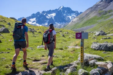
FIRST STEPS IN THE PARC NATIONAL DES ÉCRINS
The Parc national des Ecrins, covering almost 92,000 hectares, is a veritable sanctuary of nature, where mountain landscapes rival each other in beauty and ecological richness. Prepare yourself for an immersive experience close to nature, where every trail holds wondrous discoveries and unforgettable moments of contemplation.
In this unspoilt environment, flora and fauna thrive in total freedom, offering visitors a wealth of natural wonders to admire and discover. Wild animals go about their business, sometimes offering unexpected encounters, while endemic plants display their colors and fragrances, creating a veritable visual and olfactory spectacle.
Spend a few days roaming the heart of the Écrins mountains


- No dogs, even on a leash
- No picking, no taking
- No hunting
- No waste
- No fire, no noise, no disturbance
- No camping. Bivouacs are permitted from 7 p.m. to 9 a.m., more than 1 hour's walk from access roads and Park boundaries.
- No boats (recreational and water sports activities)
- No vehicles, no mountain bikes, no motorized overflights. Specific regulations for hang-gliding and gliding.
- To avoid damage and soil erosion, do not cut trail laces.
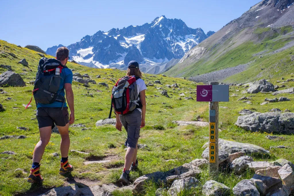
3 ideas in the Ecrins National Park
Looking for ideas for day hikes in the Ecrins National Park? Here are our 3 favorite hikes, starting from Villar d'Arène
1 - The Villar d'Arène alp

Located in the heart of the Alpine pastures, the Alpe or Chamoissière refuges welcome young and old alike, for a gourmet break during your day hike, or for a first night in a refuge, or for a stopover on the GR54 around the Ecrins.
Start: Arsine, Villar d'Arène
Ascent: 370 m
Duration: 3h
Round trip distance: 8 km
Level: easy
Maps and charts : IGN Top 25 3436 ET Meije Pelvoux
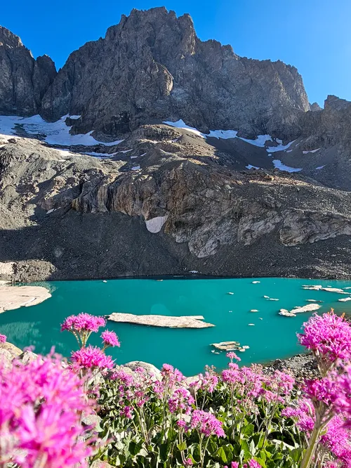
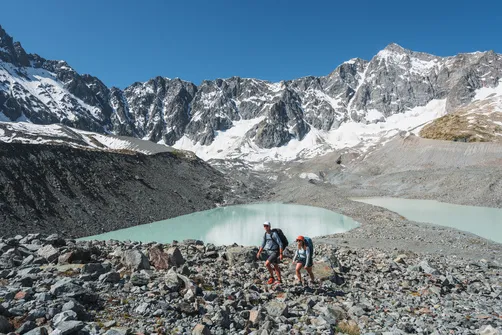
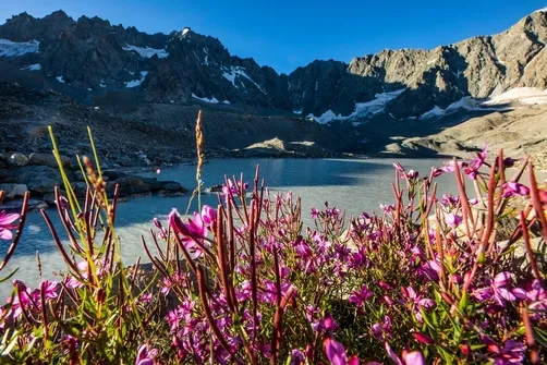
2 - The Arsine pass and glacial lakes
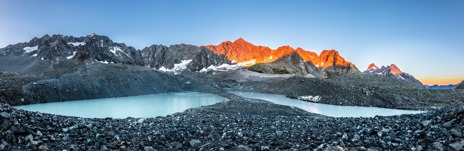
Recently created by the melting of the Glacier d'Arsine, the Lac du Glacier d'Arsine is a must-see. The glacier's cliff face, which plunges directly into the lake, lends the area a typical high-mountain atmosphere, while remaining easily accessible to hikers.
Departure point : Col du Lautaret (panoramic aerial trail) or Arsine hamlet, Villar d'Arène
Duration : 6h
Difference in altitude : 450 m /800 m
Round trip distance: 19 km
Level : medium (long)
Maps: IGN Top 25 3436 ET Meije Pelvoux
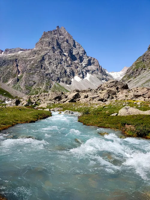
3 - Valfourche or the sources of the Romanche

Start: Arsine, Villar d'Arène
Ascent: 480 m
Duration: 5h00
Round trip distance: 15 km
Level: medium (long if you go all the way to the springs)
Maps: 3436 ET Meije Pelvoux
The itineraries complement each other perfectly, and you can do both with a night's sleep in a refuge.
You can, of course, take shorter walks, for example stopping anywhere in the bucolic valley below the Col d'Arsine and stopping at the Valfourche bridge, rather than continuing towards the sources of the Romanche.
Walks in the park
-
Villar-d'Arêne
The lake and the Pavé refuge
- Distance 18km
- Durée journalière 08:30
- Dénivelé positif 1200m
-
Villar-d'Arêne
The Source of the Romanche River
- Distance 15km
- Durée journalière 05:00
- Dénivelé positif 480m
-
Villar-d'Arêne
Arsine Lake by the Crevasses Path
- Distance 20.5km
- Durée journalière 07:00
- Dénivelé positif 500m
-
La Grave
The Grave loop at Villar d'Arène
- Distance 6km
- Durée journalière 02:30
- Dénivelé positif 366m
-
Villar-d'Arêne
Lakes and Arsine pass from Arsine
- Distance 19km
- Durée journalière 06:30
- Elevation gain 850 m
-
La Grave
The GR54 from La Grave to Arsine
- Distance 5.7km
- Durée journalière 02:00
- Dénivelé positif 440m
- Dénivelé négatif 258m
- 1
you will like also
ON FOOT IN THE PARC NATIONAL DES ÉCRINS
ReadDO YOU KNOW HOW?
Find out more