


 Back
equipment
Back
equipment
VTT N°47 : Le Tour de l'Aiguille Rouge

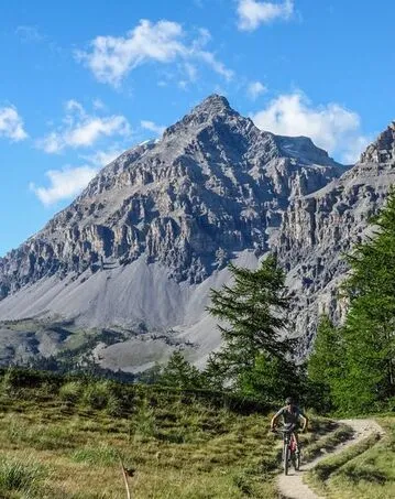
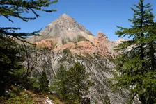

Route no. 47 on the "Espace VTT Grand Briançonnais" map: The Tour de l'Aiguille Rouge is a very difficult route: 25 km and 920 m ascent. The main difficulty is the Col des Thûres: steep ascent and technical descent.
Description
From the Roubion parking lot, take the road (D1t) up to the Col de l'Echelle, then descend on the Italian side.
At the second hairpin bend, take the path opposite, then head up the road towards Les Granges de Vallée Etroite.
At a small dam, cross the Vallée Etroite stream on the left bank as far as Lac Vert, with a short stretch on the right bank at the Granges de la Vallée Etroite.
Descend to Les Granges de la Vallée Étroite on the right bank and climb (pushing, carrying) to the Col des Thures via the GR5-GR57.
Cross the Thures valley to descend through the Clarée forest and the Roubion torrent via the GR5. End in Névache.
Facilities
-
 Mountain biking itinerary
Environments
-
 Lakeside or by stretch of water
-
Riverside
-
Mountain rental
Itinerary
-
 Distance
25km
Distance
25km
-
 Dénivelé positif
920m
Dénivelé positif
920m
Languages spoken
-
 English
-
 English
-
 Italian
Location
Animals
Pets allowed: Yes


-
Distance
25km
-
Dénivelé positif
920m