


 Back
randonnee
Back
randonnee
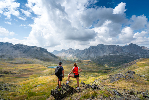
Lac Long and Lac Rond des Muandes loops
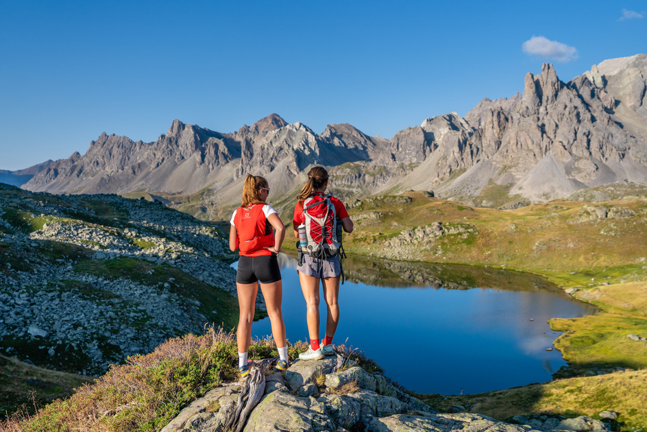

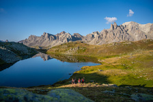
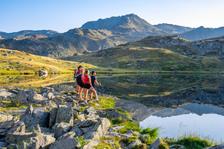
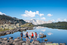
With its mountain streams, rhododendrons and alpine flora, this family-friendly loop is a must in the Haute Clarée region, with two lakes nestled at the end of the world, offering breathtaking views of the Cerces massif.
Description
This day hike climbs without difficulty through alpine pastures to reach the lac long, then the lac rond, before descending on the GR57 along the torrent de Brune to the refuge des Drayères.
From the Laval parking lot, take the wide, stony track towards the bottom of the Clarée valley (GR de Pays Tour du Mont Thabor), which overlooks the Clarée river on its left bank: continue on this track for just over a kilometer to the Lac Long sign.
At this point, leave the track and take the small path on the right: this small mountain path gradually rises through the mountain pastures and quickly joins the Riou Sec stream as far as the Lac Long weir.
Continue on the main path along the left-hand side of Lac Long, which then rises again to reach Lac Rond at 2446 m altitude: continue for around 20 minutes, crossing a "rock field" with care. Keep as far to the left as possible, as the route becomes less visible in the rocks. Once on the heights, descend towards Lac Rond on the left as far as the spillway.
Once you've reached the spillway, take the left-hand path along the spillway (which is often empty in midsummer, forming a scree bed) until you reach the Brune torrent. The path then descends (GR57), crossing several wetlands on the left bank of the torrent de Brune (a path can be seen on the other side of the torrent, but should be ignored), until it reaches the valley floor and the refuge des Drayères.
Pick up the wide, stony track and return via this to your starting point.
It is also possible to return via the right bank of the Clarée, in which case cross the footbridge 200 m below the trail.
Complément accueil
This hike, which is very popular in summer, leads to a deterioration of the vegetation near the route. We ask you to stay on the main itinerary.
Environments
-
 Presence of livestock and guard dogs
Prices
Free access.
Itinerary
-
 Distance
8.6km
Distance
8.6km
-
 Type d'itinéraire
BOUCLE
Type d'itinéraire
BOUCLE
-
 Dénivelé positif
460m
Dénivelé positif
460m
-
 Daily duration
04h30
Daily duration
04h30
-
 Marked trail
Yes
Marked trail
Yes
-
 Précision balisage
GRP markings (yellow and red) at the start of the route.
Yellow signs.
Return GR signposting
Précision balisage
GRP markings (yellow and red) at the start of the route.
Yellow signs.
Return GR signposting
-
 Nature of the terrain
Non-groomed itinerary,
Stone,
Not suitable for strollers
Nature of the terrain
Non-groomed itinerary,
Stone,
Not suitable for strollers
-
 Altitude maximum
2470m
Altitude maximum
2470m
Opening hours
From 11/05 to 11/11 daily.
Subject to favorable snow and weather conditions.
Ouverture complémentaire
-
Subject to favorable weather
-
Subject to snow conditions
Languages spoken
-
 English
Location
Animals
Pets allowed: Yes


-
Distance
8.6km
-
Daily duration
04h30
-
Dénivelé positif
460m
-
Type d'itinéraire
BOUCLE


-
Névache
Col des Muandes
- Distance 13.6km
- Durée journalière 06h00
- Dénivelé positif 830m
- Dénivelé négatif 830m
-
Névache

Mont Thabor from Laval
- Distance 20km
- Durée journalière 08h00
- Dénivelé positif 1300m
- Dénivelé négatif 1300m
-
Névache
 shared housing
Les Drayères mountain hut
-
Névache
 Not an OTHV partnershared housing
Refuge Laval
Starting at