Back
randonnee
Back
randonnee
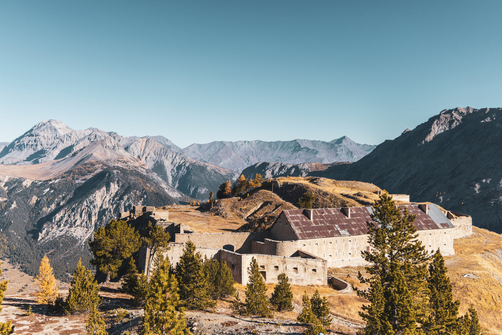
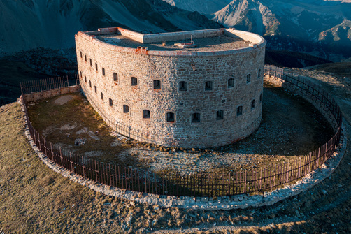
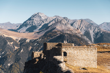
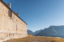
Fort de L'Olive
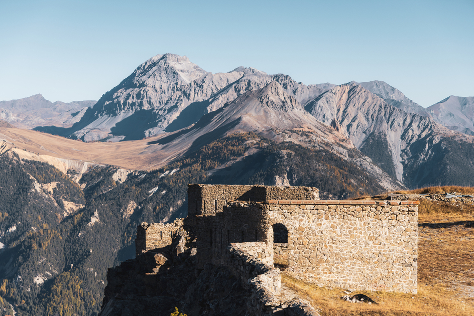
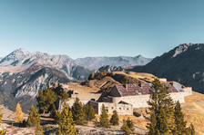
Access to this 19th-century fort perched on the Rocher de l'Olive is well worth the effort. It's a tough climb through the woods, but your efforts will be amply rewarded with an incomparable panorama of the Clarée, Granon, Acles and Echelle passes.
Description
From the parking lot on the outskirts of Plampinet, cross the road to take the wide path on the right, which rises to skirt the heights of the cemetery.
Above the cemetery, continue along the edge of the wood, then turn left at the intersection. The path gradually rises through the forest, then becomes steep: you're now on a short, steady climb.
The path leads to a flat area. This part of the route is relatively hilly.
At an intersection on the left, a large cairn marks the start of the winding climb to Fort de l'Olive. This is the first and most sustained part of the route.
You then reach a magnificent, cool, wooded clearing: the Sapet de l'Olive. Here you can catch your breath before starting the second climb.
Cross a steep scree slope: the fort is just above the route. The scree quickly leads to a small restored outpost. The path skirts the rocky outcrop to join the wide military track that leads to the entrance of Fort de l'Olive. However, it is possible to shorten this detour by leaving the itinerary on the right, and branching off a hundred or so metres after the outpost: a short path through the alpine pasture leads directly to the entrance of the Fort.
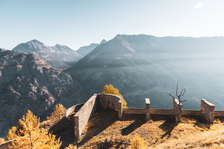
The fort, perched on the Rocher de l'Olive, offers a remarkable panorama of all the surrounding passes. The ravine below (Fonts du Creuzet), above which the Fort is built on the crest of the cime des Ruines, is just as impressive.
Return by the same route.
Option to continue towards Fort de Lenlon.
Complément accueil
Entering the forts is at your own risk. Rocks may fall.
Environments
-
 Mountain rental
Prices
Free access.
Itinerary
-
 Distance
10km
Distance
10km
-
 Type d'itinéraire
Aller/retour
Type d'itinéraire
Aller/retour
-
 Dénivelé positif
760m
Dénivelé positif
760m
-
 Daily duration
05h00
Daily duration
05h00
-
 Marked trail
Yes
Marked trail
Yes
-
 Précision balisage
Signs, yellow lines.
Précision balisage
Signs, yellow lines.
-
Passage délicat
Sustained ascent in tight switchbacks, then crossing a scree slope.
-
 Nature of the terrain
Non-groomed itinerary,
Stone,
Not suitable for strollers
Nature of the terrain
Non-groomed itinerary,
Stone,
Not suitable for strollers
-
 Altitude maximum
2223m
Altitude maximum
2223m
Opening hours
From 01/01 to 31/12 daily.
Subject to favorable snow and weather conditions.
Ouverture complémentaire
-
Subject to favorable weather
-
Subject to snow conditions
Location
Animals
Pets allowed: Yes


-
Distance
10km
-
Daily duration
05h00
-
Dénivelé positif
760m
-
Type d'itinéraire
Aller/retour