


 Back
randonnee
Back
randonnee
Cascade de Débaret
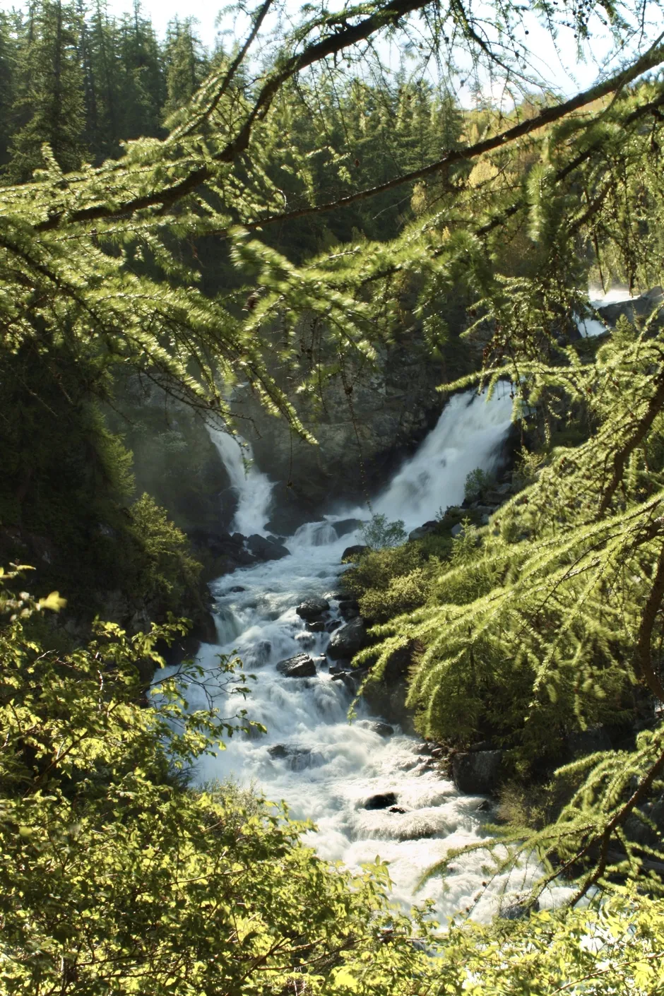
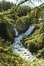
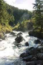
A loop that takes in the hamlet of Ville Haute, the river and one of its magnificent waterfalls. The trail winds through the forest.
Description
From the Tourist Office parking lot, take the road into the hamlet of Ville Haute. Once past the church, take the GR 57 (road on the left between 2 houses).
Cross the Outre bridge and follow the footpath slightly to the right. Follow the path until you reach a set of stairs descending to the right. This is where you'll find the Débaret waterfall.
Cross the bridge at the bottom of these steps and return along the path through the meadows to the road that leads back down to Ville Haute and back to the starting point.
Environments
-
 Forest location
-
Mountain rental
-
Waterside
Prices
Free access.
Itinerary
-
 Distance
8km
Distance
8km
-
 Type d'itinéraire
BOUCLE
Type d'itinéraire
BOUCLE
-
 Dénivelé positif
63m
Dénivelé positif
63m
-
 Daily duration
01:30
Daily duration
01:30
-
 Marked trail
Yes
Marked trail
Yes
-
 Nature of the terrain
Rock,
Stone,
Ground,
Not suitable for strollers
Nature of the terrain
Rock,
Stone,
Ground,
Not suitable for strollers
-
 Altitude maximum
1663m
Altitude maximum
1663m
Opening hours
All year round daily.
Subject to favorable snow and weather conditions.
Ouverture complémentaire
-
Subject to favorable weather
-
Subject to snow conditions
Languages spoken
-
 English
Location
Thèmes
-
Guidebook with maps/step-by-step : From the Tourist Office parking lot, take the road into the hamlet of Ville Haute. Once past the church, take the GR 57 (road on the left between 2 houses). Cross the Outre bridge and follow the footpath slightly to the right ahead. Follow the path until you reach a set of stairs on your right, at which point you'll see the Débaret waterfall. Cross the bridge at the bottom of these steps and return along the path through the meadows to the road that leads back down to Ville Haute and back to your starting point.


-
Distance
8km
-
Daily duration
01:30
-
Dénivelé positif
63m
-
Type d'itinéraire
BOUCLE