


 Back
equipment
Back
equipment
Ascent of Col de l'Échelle from La Vachette

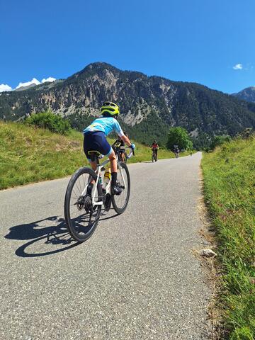
Discover the entire Clarée valley by bike as you climb the Col de l'Échelle. Along the river, between hamlets and forests, this small departmental road will take you to its verdant plateau at 1762 meters altitude.
Description
The Col de l'Echelle is a must for cyclists in the Briançonnais region.
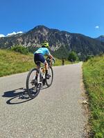
Culminating at 1762m, your departure from the hamlet of La Vachette (1360m) will clock in at 17km (one way) and just over 400 metres of ascent on a small asphalt road.
The ascent to the Col de l'Echelle is a gentle one via the hamlets of Val-des-Prés and Plampinet, with an average gradient of 3%.
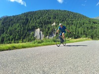
Once you've reached Névache, the hardest part begins, with 3 km at a gradient of almost 8%, before returning to the plain of the Col de l'Echelle and descending on the Vallée Étroite side for 12 km.
On your return, don't hesitate to pedal through the various hamlets of Névache, to visit this mountain village at an altitude of almost 1600 metres.
Length from La Vachette: 17 km
Difference in altitude: 400 m
Average gradient: 2.3%
Maximum gradient: 9.4%
Facilities
-
 Cycle tourism route
Complément accueil
Follow the Cols Réservés calendar: cycling enthusiasts can realize their dreams in complete safety: the climbs of mythical cols and resorts are closed to motorized traffic and reserved for cyclists in the morning. Free access, open to all, with no registration, no ranking, no start and no finish.
Environments
-
 Mountain rental
Itinerary
-
 Distance
31km
Distance
31km
-
 Type d'itinéraire
Aller/retour
Type d'itinéraire
Aller/retour
-
 Dénivelé positif
470m
Dénivelé positif
470m
-
 Downhill elevation
470m
Downhill elevation
470m
-
 Marked trail
Yes
Marked trail
Yes
-
 Nature of the terrain
Hard coating (tar, cement, flooring)
Nature of the terrain
Hard coating (tar, cement, flooring)
-
 Altitude maximum
1762m
Altitude maximum
1762m
Opening hours
Please note that the Col de l'Echelle is closed in winter.
For opening conditions, please visit http://inforoute.hautes-alpes.fr/.
Languages spoken
-
 English
-
 Italian
Location


-
Distance
31km
-
Dénivelé positif
470m
-
Downhill elevation
470m
-
Type d'itinéraire
Aller/retour