


 Retour
equipement
Retour
equipement
The Col des Peygus by ski touring

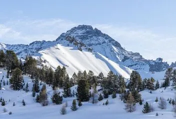

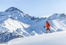
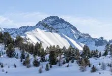
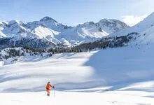
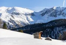
The Col des Peygus is a very scenic ski touring route once you've passed the Chalets de l'Izoard. The ascent is not particularly difficult in terms of altitude, but rather in terms of length.
Description
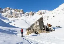
From Le Laus de Cervières, follow the groomed track towards the Col de l'Izoard.
Halfway to the pass, leave the track and turn right into the forest, towards the Chalets d'Izoard.
Once past the chalets, panoramic views open up all the way to the Col des Peygus.
Follow the gpx track to the highest point.
Équipements
-
 Ski touring route
Complément accueil
Because of the risk of avalanche, we strongly recommend that you wear full safety equipment (avalanche transceiver, shovel and probe).
Ski touring is a risky activity, and all skiers are responsible for their own safety.
It is therefore strongly recommended to hire a mountain guide to supervise outings in unmarked and unsafe areas.
It is also advisable to prepare your outing well in advance: consult the BRA (Bulletin d'Estimation du Risque d'Avalanche), check the inclination of slopes on the Géoportail slope map to avoid itineraries on slopes of over 30°, and check with the guide office to find out whether conditions are favorable.
Environnements
-
 Mountain location
Tarifs
Free access.
Itinéraire
-
 Distance
8km
Distance
8km
-
 Type d'itinéraire
Aller simple
Type d'itinéraire
Aller simple
-
 Dénivelé positif
880m
Dénivelé positif
880m
-
 Dénivelé négatif
880m
Dénivelé négatif
880m
-
 Durée journalière
03:00
Durée journalière
03:00
-
 Itinéraire balisé
Oui
Itinéraire balisé
Oui
Période d'ouverture
From 01/12 to 30/04 daily.
Subject to favorable snow and weather conditions.
Ouverture complémentaire
-
Subject to favorable weather
-
Subject to snow conditions
Langues parlées
-
 French
Tourisme adapté
-
Not accessible in a wheelchair
Localisation
Animaux
Animaux acceptés : Oui


-
Distance
8km
-
Durée journalière
03:00
-
Dénivelé positif
880m
-
Dénivelé négatif
880m