


 Retour
randonnee
Retour
randonnee
The Col des Ayes

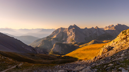
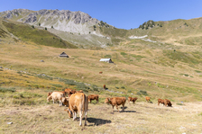
This wild hike follows the GR5 through the Bois des Ayes and its Biological Reserve to the Col des Ayes, which marks the boundary with the Queyras Regional Nature Park.
Description
Park at the entrance to the hamlet of Chalets des Ayes, then cross the hamlet to the last chalets, following the GR5 ( direction Col des Ayes / Brunissard ) to the left.
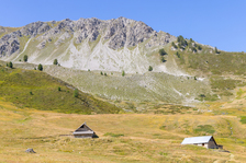
The route then enters the Bois des Ayes forest on the left bank of the torrent, as a wide forest track for 3.2 km to the "Chalets de vers le Col".
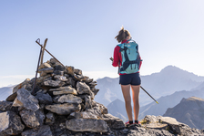
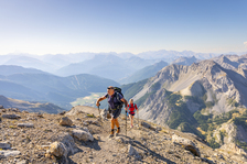
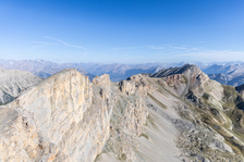
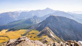
Following the GR, this wide track continues for 1km and ends as a small path to the pass, crossing scree and meadows. The Queyras peaks and the Queyras Regional Nature Park stretch out before our eyes.
The return journey takes the same route.
Complément accueil
Certain parts of the Bois des Ayes Natura 2000 site are protected areas with specific regulations, and the law provides for fines in the event of infringement. In particular, the Bois des Ayes reserve aims to protect nesting woodpeckers, nocturnal birds of prey and black grouse.
The site is open to all, but please remember to observe the following recommendations:
- Stay on marked trails
- Keep your dog on a leash
- Behave discreetly
- Photograph flowers and animals from the paths
- Leave stones in their place
- Do not light fires
- Bring back your garbage
Environnements
-
 Forest location
-
Mountain view
-
In a nature reserve
-
Panoramic view
Tarifs
Free access.
Itinéraire
-
 Distance
10km
Distance
10km
-
 Type d'itinéraire
Aller/retour
Type d'itinéraire
Aller/retour
-
 Dénivelé positif
770m
Dénivelé positif
770m
-
 Durée journalière
04h30
Durée journalière
04h30
-
 Itinéraire balisé
Oui
Itinéraire balisé
Oui
-
 Altitude maximum
2491m
Altitude maximum
2491m
Période d'ouverture
From 15/05 to 15/11 daily.
Subject to favorable snow and weather conditions.
Ouverture complémentaire
-
Subject to favorable weather
-
Subject to snow conditions
Localisation
Animaux
Animaux acceptés : Oui


-
Distance
10km
-
Durée journalière
04h30
-
Dénivelé positif
770m
-
Type d'itinéraire
Aller/retour


