


 Retour
randonnee
Retour
randonnee
La Cime de la Condamine
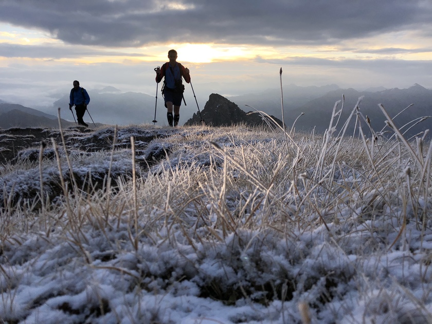
A remarkable lookout perched at an altitude of almost 3,000m in the heart of the Partias Reserve, this hike offers incomparable views of the Écrins massif and unique vistas of the Vallouise and Durance valleys.
Description
Park in the parking lot just beyond the hamlet of Les Combes.
Follow the dirt track to the barrier marking the entrance to the Partias Regional Nature Reserve. A descriptive sign explains the regulations in force and the specific features of this reserve.
Cross the barrier and continue straight into the heart of the Partias via a wide path for around 600 meters.
At the fork, take the left-hand path towards Col de la Trancoulette (signposted). The path climbs up through the forest below Rocher Jaune, up a valley and then begins a short, steady ascent to the pass.
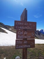
At the pass, take the right-hand path (signposted Cime de la Condamine). The path crosses the vast "Clot des Amandiers" mountain pasture and skirts two small lakes until it reaches the "Peyre du Feu" area. The path is partially marked in places, follow the cairns to the Col de Vallouise.
At the Col de Vallouise, take the right-hand path, which is well-marked and rises into the mountain. The path then winds a little steeper through the rocky bars, with two tricky passages in the escarpments, before reaching the large dome of the Cime de la Condamine. The return journey takes the same route.
Alternatively, you can continue via the Crête de Coste Groselière and then descend via the Col de la Pisse and Fond de Closis/Vallon des Partias.
Complément accueil
Two slightly technical passages in the rocky bar above the Col de Vallouise.
To preserve this area, Reserve staff are responsible for enforcing the regulations and advising all users.
Savoir Vivre en Réserve :
- Stay on the trails
- Dogs must be kept on a leash
- Picking plants and flowers prohibited
- Bring your own garbage
- Camping and fires prohibited, bivouacs authorized
- Motorized traffic prohibited
- Respect the tranquillity of the site
Environnements
-
 Mountain view
-
Mountain location
-
Panoramic view
Tarifs
Free access.
Itinéraire
-
 Distance
12km
Distance
12km
-
 Type d'itinéraire
Aller/retour
Type d'itinéraire
Aller/retour
-
 Dénivelé positif
1100m
Dénivelé positif
1100m
-
 Dénivelé négatif
1100m
Dénivelé négatif
1100m
-
 Durée journalière
07h00
Durée journalière
07h00
-
 Itinéraire balisé
Oui
Itinéraire balisé
Oui
-
 Précision balisage
Follow the signs to the Col de la Trancoulette, then follow the cairns and old stone markings to the summit.
A map is available at the entrance to the reserve.
Précision balisage
Follow the signs to the Col de la Trancoulette, then follow the cairns and old stone markings to the summit.
A map is available at the entrance to the reserve.
-
Passage délicat
Two slightly technical passages in the rocky bar above the Col de Vallouise.
-
 Altitude moyenne
2400m
Altitude moyenne
2400m
-
 Altitude maximum
2940m
Altitude maximum
2940m
Période d'ouverture
From 01/06 to 31/10 daily.
Subject to favorable snow and weather conditions.
Ouverture complémentaire
-
Subject to favorable weather
-
Subject to snow conditions
Tourisme adapté
-
Not accessible in a wheelchair
Localisation
Animaux
Animaux acceptés : Oui


-
Distance
12km
-
Durée journalière
07h00
-
Dénivelé positif
1100m
-
Dénivelé négatif
1100m


