


 Retour
equipement
Retour
equipement
From Villard-Saint-Pancrace to Col du Galibier
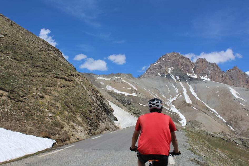

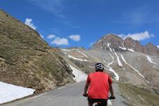
Take on one of the most legendary passes in the Alps: the Col du Galibier!
Description
From the Centre Montagne parking lot, take the road on the left, then take the first road on the left again to reach the village center.
Go straight ahead at the next two stop signs.
At the traffic circle next to Bialler, take the leftmost exit to cross the bridge.
At the next traffic circle, take the 1st right and continue straight ahead. Drive through the traffic lights, heading for Grenoble.
At the next traffic circle, above Géant Casino, take the left-hand exit, heading for Grenoble.
At the Briançon exit, take the second exit off the traffic circle, heading for Grenoble, then drive up the Serre Chevalier valley to the Col du Lautaret, for about 23 km.
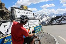
At the pass, turn right towards the Col du Galibier and drive up the pass.
At the traffic lights in the Galibier tunnel, turn right to complete the ascent of the pass.
Équipements
-
 Cycle tourism route
-
Free car park
Environnements
-
 Mountain view
Tarifs
Free access.
Itinéraire
-
 Distance
79.7km
Distance
79.7km
-
 Type d'itinéraire
Aller/retour
Type d'itinéraire
Aller/retour
-
 Dénivelé positif
1584m
Dénivelé positif
1584m
-
 Dénivelé négatif
1589m
Dénivelé négatif
1589m
-
 Durée journalière
03h45
Durée journalière
03h45
-
 Itinéraire balisé
Oui
Itinéraire balisé
Oui
-
 Précision balisage
The route is signposted by road signs and by dedicated milestones for cyclists. These markers are placed every kilometer of the ascent after Briançon, and indicate the gradient of the road for the next kilometer and the number of kilometers remaining to the top of the pass.
Précision balisage
The route is signposted by road signs and by dedicated milestones for cyclists. These markers are placed every kilometer of the ascent after Briançon, and indicate the gradient of the road for the next kilometer and the number of kilometers remaining to the top of the pass.
-
 Nature du terrain
Hard coating (tar, cement, flooring)
Nature du terrain
Hard coating (tar, cement, flooring)
-
 Altitude moyenne
1900m
Altitude moyenne
1900m
-
 Altitude maximum
2619m
Altitude maximum
2619m
Période d'ouverture
From 01/06 to 30/09 daily.
Subject to snow conditions.
Ouverture complémentaire
-
Subject to snow conditions
Langues parlées
-
 French
Localisation


-
Distance
79.7km
-
Durée journalière
03h45
-
Dénivelé positif
1584m
-
Dénivelé négatif
1589m