Retour
randonnee
Retour
randonnee
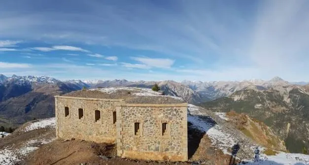
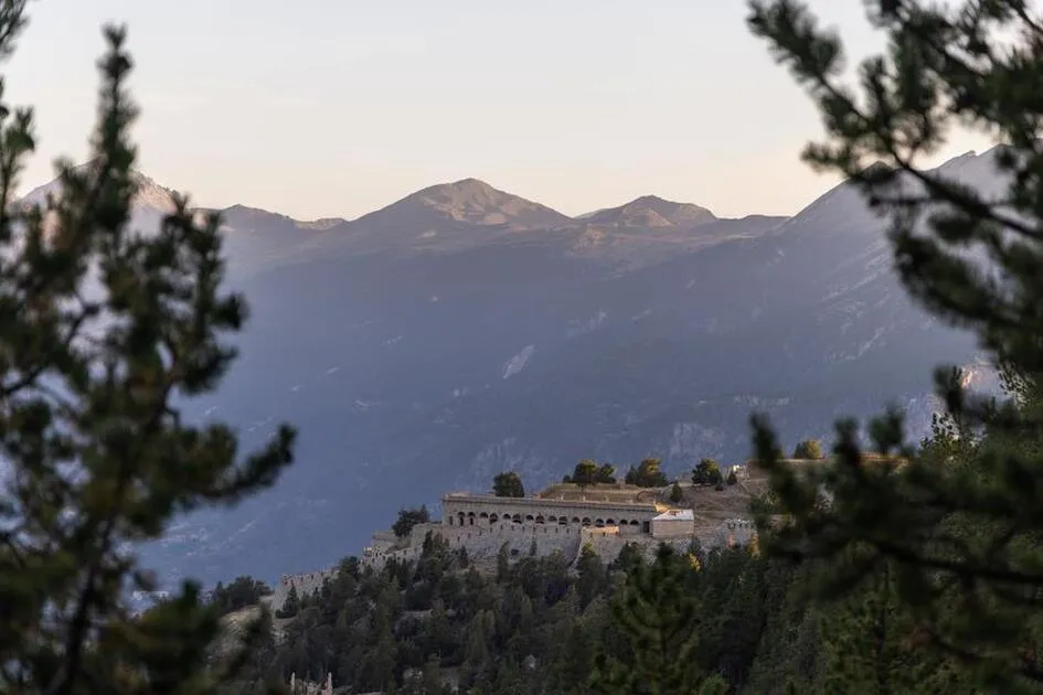
Fort de la Grande Maye
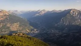


This hike offers a fascinating panorama on arrival between the viewpoint and the fort.
From the heights, you can see the Ecrins massif, Italy, the Queyras and the Lausette fort.
Description
It's a beautiful hike leading to a fort built for defensive purposes after France's defeat by Prussia.
From the parking lot at the children's home, head towards the Croix de Bretagne fort, first passing the Four à Chaux and then the wide forest track winding up to the fort.
Once you reach the first fort, the track becomes narrower. Continue towards the old Grande Maye fort and the hamlet of Pied Sec until you reach an intersection. At this intersection, turn left and take the last part of the route.
Return along the same route to the Croix de Bretagne fort, then fork right, skirting the fortifications, before descending through the Godichon woods and returning to the starting point.
Environnements
-
 In the country
Tarifs
Free access.
Itinéraire
-
 Distance
21km
Distance
21km
-
 Type d'itinéraire
BOUCLE
Type d'itinéraire
BOUCLE
-
 Dénivelé positif
1100m
Dénivelé positif
1100m
-
 Dénivelé négatif
1100m
Dénivelé négatif
1100m
-
 Durée journalière
06:00
Durée journalière
06:00
-
 Itinéraire balisé
Oui
Itinéraire balisé
Oui
-
 Nature du terrain
Rock,
Stone,
Ground,
Grit,
Not suitable for strollers
Nature du terrain
Rock,
Stone,
Ground,
Grit,
Not suitable for strollers
Période d'ouverture
From 15/05 to 11/11 daily.
Subject to favorable snow and weather conditions.
Ouverture complémentaire
-
Subject to favorable weather
-
Subject to snow conditions
Langues parlées
-
 French
Tourisme adapté
-
Not accessible in a wheelchair
Localisation
Animaux
Animaux acceptés : Oui


-
Distance
21km
-
Durée journalière
06:00
-
Dénivelé positif
1100m
-
Dénivelé négatif
1100m