


 Retour
randonnee
Retour
randonnee
Col de Bousson loop

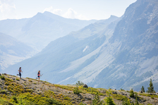
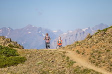
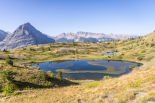
This pretty, easy loop to the Col de Bousson offers breathtaking views of the Fonts de Cervières and the Italian peaks. Along the way, you'll come across numerous small lakes hidden in the depths of vast alpine meadows.
Description
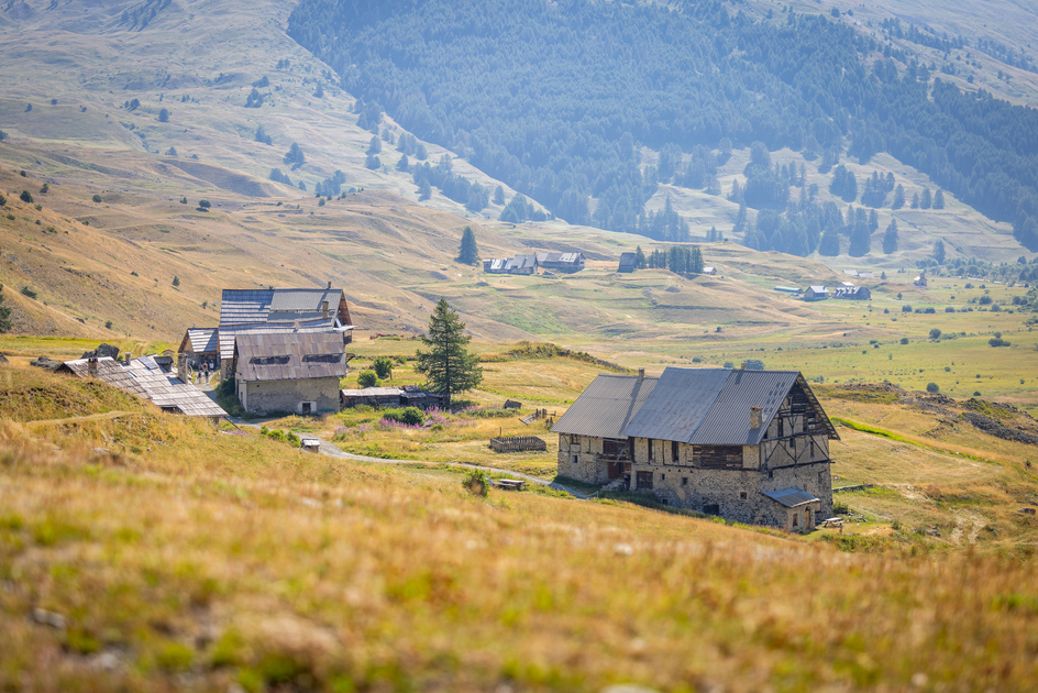
Park in the Le Bourget parking lot at the end of the main straight at Pont level.
Backtrack via the road to the dirt track and the Chapelle de la Transfiguration. Drive around the chapel, then turn left along the dirt road towards the hamlet of Hugues.
Once in the hamlet, head for the second hamlet of Rif Rord just above.
Just before the hamlet, take the right-hand track that rises through the mountain pastures to a sheepfold and Lac des Chiens. The path skirts the lakes on the left, then continues towards two more lakes and passes under the Rocher Renard. Pass under the rock, then continue 700 m to the Col de Bousson. A border marker indicates the Franco-Italian border crossing. From this pass you can see the Sestrières ski resort.
Cross the ridge to the Italian side, then turn right around the ridge to reach a second small pass at the Crête du Souré.
Descend the entire valley towards the hamlet of Le Bourget to reach your starting point.
Complément accueil
This itinerary borders on the Rochebrune - Izoard - Vallée de la Cerveyrette Natura 2000 site. Although the route is not on a listed site, it is essential to preserve the site by staying on the trails.
Environnements
-
 Mountain view
-
Mountain location
-
Overview on river
-
In a nature reserve
Tarifs
Free access.
Itinéraire
-
 Distance
6.5km
Distance
6.5km
-
 Type d'itinéraire
BOUCLE
Type d'itinéraire
BOUCLE
-
 Dénivelé positif
326m
Dénivelé positif
326m
-
 Dénivelé négatif
326m
Dénivelé négatif
326m
-
 Durée journalière
03h00
Durée journalière
03h00
-
 Itinéraire balisé
Oui
Itinéraire balisé
Oui
-
 Précision balisage
Yellow signs
Précision balisage
Yellow signs
-
 Nature du terrain
Non-groomed itinerary,
Stone,
Ground,
Not suitable for strollers
Nature du terrain
Non-groomed itinerary,
Stone,
Ground,
Not suitable for strollers
-
 Altitude moyenne
1900m
Altitude moyenne
1900m
-
 Altitude maximum
2154m
Altitude maximum
2154m
Période d'ouverture
From 15/05 to 15/11 daily.
Subject to favorable snow and weather conditions.
Ouverture complémentaire
-
Subject to favorable weather
-
Subject to snow conditions
Localisation
Animaux
Animaux acceptés : Oui


-
Distance
6.5km
-
Durée journalière
03h00
-
Dénivelé positif
326m
-
Dénivelé négatif
326m


