


 Retour
randonnee
Retour
randonnee
The Pavé refuge from Villar d’Arène
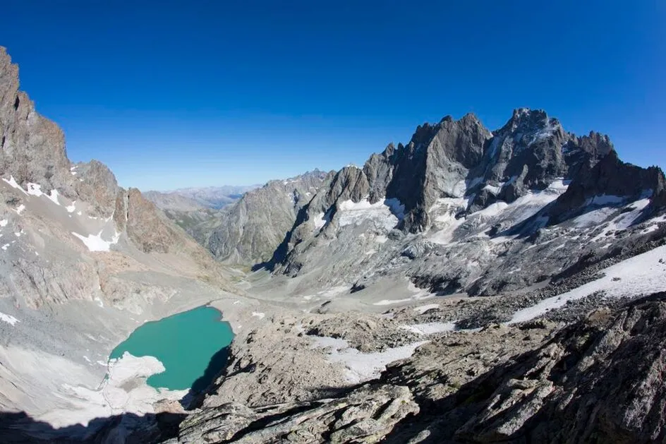

A hike for immersion in incredible alpine landscapes, where the goal is to discover the Pavé lake. Life, at an altitude of 2800 m.
Description
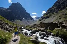
Leaving from the Arsine parking lot (next to the municipal campsite), the path to the refuge du Pavé first follows the busy path to the Alpe de Villar d'Arène refuge (GR 54).
It leaves it at the top of the glacial lock known to locals as "Les voûtes". It then follows the Romanche on its right bank for 2 km to the Plan de l'Alpe, once coveted as a hydroelectric dam.
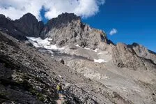
At the Valfourche bridge, which marks the entrance to the heart of the Ecrins National Park, the route switches to the left bank. It leaves the Romanche valley and heads up the Cavales valley, first along the banks of the torrent of the same name to Les Pichettes, which marks the end of the alpine grassland. The valley then becomes entirely mineral. The path follows the crest of the remarkable moraine to below the Col du Clot des Cavales, skirting a system of rocky bars to reach the refuge and Lac du Pavé.
The return journey takes the same route.
Complément accueil
Hard
Tarifs
Free access.
Itinéraire
-
 Distance
10.85km
Distance
10.85km
-
 Type d'itinéraire
Aller simple
Type d'itinéraire
Aller simple
-
 Dénivelé positif
1203m
Dénivelé positif
1203m
-
 Dénivelé négatif
99m
Dénivelé négatif
99m
-
 Durée journalière
04:00
Durée journalière
04:00
-
 Itinéraire balisé
Oui
Itinéraire balisé
Oui
-
 Précision balisage
Grande Randonnée signposting - Petite Randonnée signposting
Précision balisage
Grande Randonnée signposting - Petite Randonnée signposting
-
 Altitude maximum
2903m
Altitude maximum
2903m
Période d'ouverture
From 01/06 to 31/10 daily.
Subject to favorable snow and weather conditions.
Ouverture complémentaire
-
Subject to favorable weather
-
Subject to snow conditions
Langues parlées
-
 French
Localisation
Documents


-
Distance
10.85km
-
Durée journalière
04:00
-
Dénivelé positif
1203m
-
Dénivelé négatif
99m