


 Retour
randonnee
Retour
randonnee
Laurichard Mountain Pass

Permafrost and rock glacier... a hike in the land of cold pebbles.
Description
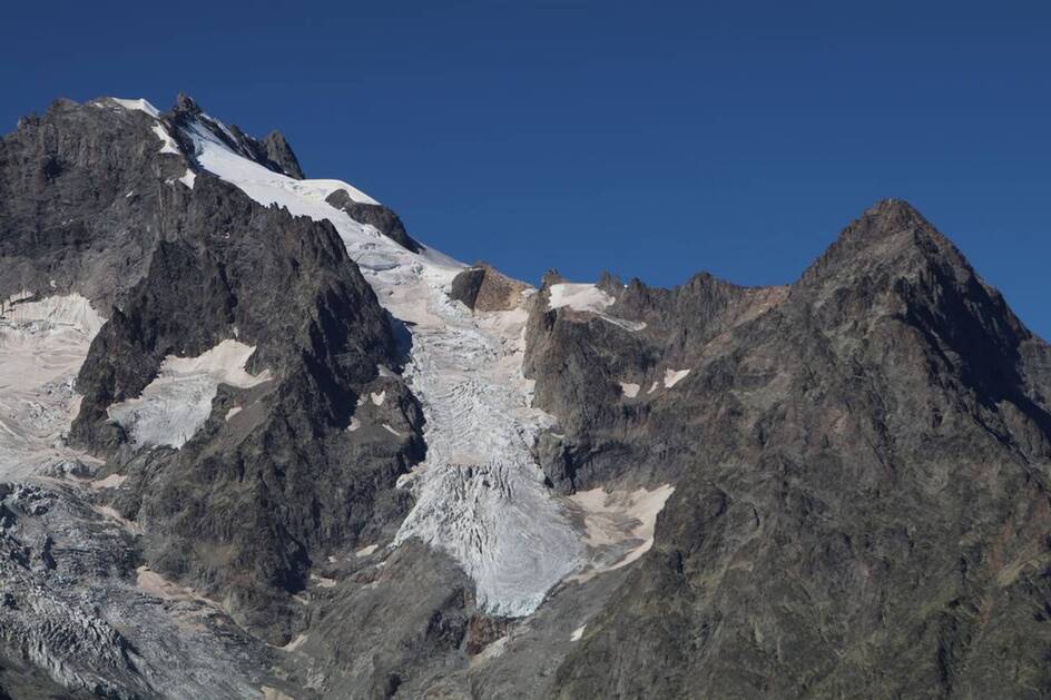
On the track, at an altitude of about 2500 m, look about! In the South/South East direction you can see at the foot of the Western peak of the Combeynot four white spheres (about 35 cm in diameter)... they are the landmarks enabling scientists to measure the evolution of the rock glacier at Laurichard.
Tarifs
Free access.
Bons plans
Put a top in your bag; the weather changes so quickly at these altitudes.
Is in the midst of the park : The national park is an unrestricted natural area but subjected to regulations which must be known by all visitors.
Herd protection dogs : In mountain pastures, protection dogs are there to protect the herds from predators (wolves, etc.).When I hike I adapt my behavior by going around the herd and pausing for the dog to identify me.Find out more about the actions to adopt with the article "Protection dogs: a context and actions to adopt".Tell us about your meeting by answering this survey.
Itinéraire
-
 Distance
5.83km
Distance
5.83km
-
 Type d'itinéraire
Aller/retour
Type d'itinéraire
Aller/retour
-
 Dénivelé positif
601m
Dénivelé positif
601m
-
 Dénivelé négatif
601m
Dénivelé négatif
601m
-
 Durée journalière
04h00
Durée journalière
04h00
-
 Altitude maximum
2637m
Altitude maximum
2637m
Localisation
Documents

Thèmes
-
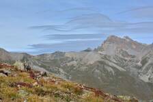
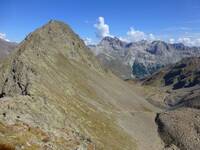
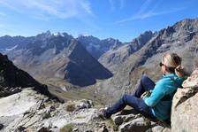
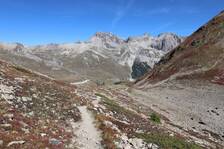
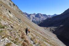
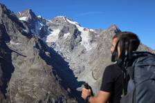
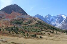
Guidebook with maps/step-by-step : Leave the car park at the foot of Serre Orel to start the ascent in the direction of the Combe de Laurichard. Do not hesitate to look at the signs in the car park, marked « porte du parc national des Ecrins ». 250 m after the car park, the track divides into tow: stay on the one that goes up towards Laurichard and leave to your right the « track for the interpretation of crevasses ». The slope accentuates progressively up to the entrance of the Combe de Laurichard (alt. 2300 m), mineral world ‘par excellence’. The path follows its route at the foot of the South-East face of the pyramid of Laurichard and looks up at the imposing Northern faces, somber and austere, the summits at Combeynot (black rock of Combeynot and the West peak of Combeynot). It is at the foot of these two mineral giants that the Laurichard rock glacier is found with its permafrost – the soil is permanently frozen – but for how much longer, due to global warming? - Continue the ascent to reach Laurichard mountain pass, the panorama embraces the entire Meije massif and the surrounding summits (pic Gaspard, pointe Nérot, Bec de l’Homme,). For the descent, use the same itinerary in the opposite direction.
-
Tips : Put a top in your bag; the weather changes so quickly at these altitudes.
Is in the midst of the park : The national park is an unrestricted natural area but subjected to regulations which must be known by all visitors.
Herd protection dogs : In mountain pastures, protection dogs are there to protect the herds from predators (wolves, etc.).When I hike I adapt my behavior by going around the herd and pausing for the dog to identify me.Find out more about the actions to adopt with the article "Protection dogs: a context and actions to adopt".Tell us about your meeting by answering this survey.


-
Distance
5.83km
-
Durée journalière
04h00
-
Dénivelé positif
601m
-
Dénivelé négatif
601m