Retour
randonnee
Retour
randonnee
From Pic du Mas to Goléon
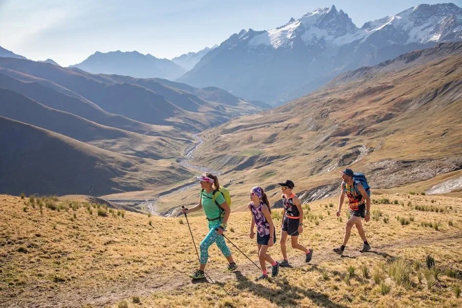

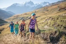
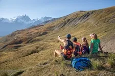
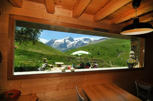
Between mountain pastures and ridges, this route links the Pic du Mas de la Grave refuge to the Goléon refuge. Facing the Meije and its glaciers, the traverse offers superb views of the Aiguilles de la Saussaz before crossing the Cruq des Aiguilles.
Description
From the Pic du Mas de la Grave refuge, the itinerary takes in mountain pasture paths overlooking the La Grave valley. Progress alternates between pastoral tracks and balcony paths, offering sweeping panoramas of the Meije and its glaciers, omnipresent on the horizon.
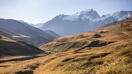
The route then crosses vast pastures and several combes and torrents descending from neighboring peaks. As you cross, the scenery changes between alpine pastures, schistous terrain and mineral slopes, typical of this high-mountain sector.
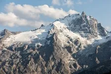
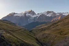
The final climb to Cruq des Aiguilles is the last effort of the day. From this panoramic passage, views unfold over the Aiguilles de la Saussaz, the Aiguille du Goléon and the great peaks of the Écrins massif.
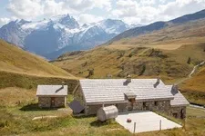
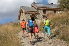
The descent then leads quickly to the Goléon refuge, nestled above the lake, facing the mineral cirque and glaciers of the Meije. The peaceful atmosphere makes it an ideal stopover in the heart of this high mountain landscape.
Complément accueil
We advise you to book accommodation well in advance, given its small capacity.
Map-reading skills are essential.
Recommended equipment :
- Mountain boots suitable for walking on varied terrain (rigid soles)
- Rain gear
- Warm clothing
- Pair of telescopic poles
- Tour des Aiguilles d'Arve IGN map
- Sufficient water and food
- Cheques or cash (CB terminals not always available in refuges)
Environnements
-
 Mountain location
Tarifs
Free access.
Itinéraire
-
 Distance
15.4km
Distance
15.4km
-
 Type d'itinéraire
Aller simple
Type d'itinéraire
Aller simple
-
 Dénivelé positif
1057m
Dénivelé positif
1057m
-
 Dénivelé négatif
532m
Dénivelé négatif
532m
-
 Durée journalière
07:10
Durée journalière
07:10
-
 Itinéraire balisé
Oui
Itinéraire balisé
Oui
-
 Précision balisage
Yellow paint, iron stakes for high-altitude alpine pastures, yellow Tour du pays des Aiguilles d'Arves plaques.
Précision balisage
Yellow paint, iron stakes for high-altitude alpine pastures, yellow Tour du pays des Aiguilles d'Arves plaques.
-
 Nature du terrain
Rock,
Ground,
Not suitable for strollers
Nature du terrain
Rock,
Ground,
Not suitable for strollers
Période d'ouverture
From 20/06 to 22/09 daily.
Subject to favorable snow and weather conditions.
Ouverture complémentaire
-
Subject to favorable weather
-
Subject to snow conditions
Langues parlées
-
 French
Localisation
Documents

Thèmes
-
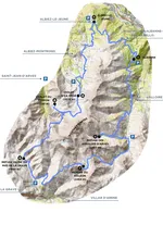
Guidebook with maps/step-by-step : 1/ Take the path that begins between the cabane des gardiens and the boulodrome, then cross the Courbieille torrent.
2/ Follow the track for 300 m to reach a balcony trail leading to the Croix de Tuf.
3/Turn left on the trail to reach the Rivet de la Cime, then the Rivet du milieu.
4/ At the last chalet of the Rivet du milieu, turn left onto a grassy track which climbs and then becomes a path (markings 4 green).
5/Enter a cow park, climb a steep slope, then continue on a balcony path into the combe de Martignare.
6/Cross the Martignare torrent on a footbridge, then continue straight ahead before turning right at a hairpin bend.
7/Then leave the green markings to take the quad track at a large boulder.
8/ Pass under the ski lift, turn left at Les Plagnes and climb the hairpin bends leading to the Col des Plagnes.
9/ From the pass, turn left along the wooden paravalanches to reach Cote Rouge.
10/ Continue along the ridge to Signal de La Grave. Leave the path that climbs due north on the ridge and take the path below to the right at the level of the flat area after the Signal.
11/ Descend to the Puy Garnier chalet, which lies below a mountain pasture chalet, then turn slightly left to reach a stream.
12/ After the torrent, continue down the slope for 20 m, then turn right.
13/ Continue along the cow pasture until you come to a water catchment area marked out by sheep nets, which you must pass to the left.
14/ At the top of the pen, turn right and walk along it until you reach a scree slope.
15/ Cross the plateau, then turn right to begin the ascent to Cruq des aiguilles.
16/ At the Cruq, head downhill on a cairn-marked track to the refuge.


-
Distance
15.4km
-
Durée journalière
07:10
-
Dénivelé positif
1057m
-
Dénivelé négatif
532m